TARANIS –

Design and development of a platform based on advanced technologies for flood prediction and autonomous response through smart nodes and sensors and geospatial systems.
TARANIS is a project co-financed by the European Union through the European Regional Development Fund (ERDF) under the 2021-2027 Multiregional Programme for Spain, with the support of CDTI Innovación.
Europa Se Siente
Project description
TARANIS is a research and development project promoted by INDEPRO Consultores de Ingeniería, S.L., for the design and development of an advanced technological platform aimed at the prediction, monitoring and automated issuance of early warnings for pluvial and fluvial flooding.
The platform will integrate artificial intelligence, multi-source hydrometeorological analysis, smart nodes and sensors, and interactive geospatial systems. Its purpose is to develop an autonomous system covering the full early warning cycle: from data acquisition and processing to risk prediction, cartographic representation and notification to public administrations, civil protection agencies, infrastructure managers and citizens.
The system will combine information from field sensors, meteorological and gauging stations, official sources, weather forecasting services and Earth observation systems. The data will be processed through a distributed architecture and used to develop and validate predictive models for streamflow, rainfall and flood risk.
Project data
CDTI reference
IDI-20260398
Implementation period
15 May 2025 – 31 October 2026
Duration
18 months
Beneficiary entity
INDEPRO Consultores de Ingeniería, S.L.
Total budget
€221,869.00
European Union support
€47,531.00
Gross Grant Equivalent
General objective of TARANIS
To design and develop a modular, scalable and interoperable technological platform, based on artificial intelligence, multi-source hydrometeorological analysis and geospatial systems, capable of predicting and monitoring flood events, continuously assessing the level of risk and issuing automated, georeferenced early warnings.
The platform will be aimed at both technical and non-technical users, with special attention to civil protection agencies, public administrations, infrastructure managers and citizens exposed to flood risk.
Specific objectives
-
Multi-source data integration
Design and implement a distributed architecture for the continuous acquisition, ingestion and storage of hydrometeorological data from field sensors, official stations, meteorological services and Earth observation systems.
-
Data processing and harmonisation
Develop a processing module capable of cleaning, validating, interpolating, transforming and standardising the collected data, ensuring its quality and compatibility with the platform’s predictive models.
-
Advanced predictive models
Create, evaluate and validate artificial intelligence models to predict streamflow, rainfall intensity and flood risk, combining techniques such as LSTM networks, convolutional neural networks, decision trees and hybrid models through an ensemble approach.
-
Territorial interpretation and adaptive warnings
Implement a semantic module that automatically interprets hydrometeorological variables according to the territorial context, enabling the generation of georeferenced warnings adapted to the level of risk, local vulnerability and user profile.
-
Hydrological and hydraulic validation
Compare predictions generated by artificial intelligence with traditional hydrological and hydraulic models, such as HEC-HMS and IBER, to assess their accuracy, physical consistency, robustness and applicability across different river basins.
-
Geospatial web platform
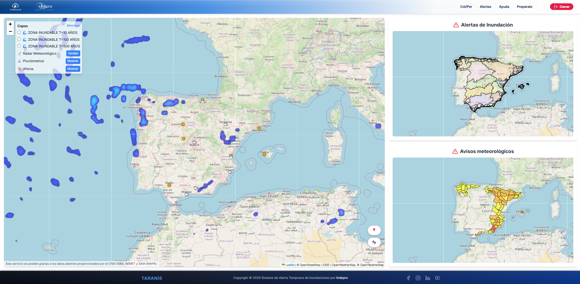
Develop an interactive web viewer, accessible from desktop computers and mobile devices, allowing users to consult meteorological and hydrological data, forecasts, risk levels, territorial maps and active warnings.
Scope of implementation
Place of development: Ávila, Castile and León.
Thematic scope: artificial intelligence applied to hydrological forecasting, early warning systems, smart sensors, hydrometeorological analysis and geographic information systems.
Initial study and validation case: upper basin of the Adaja River, using hydrometeorological time series, gauging station data, rainfall information and territorial cartography.
Target users
TARANIS is primarily aimed at:
- Public administrations and local authorities.
- Civil protection agencies.
- River basin authorities and water planning bodies.
- Critical infrastructure managers.
- Companies and organisations exposed to climate risk.
- Population living in territories vulnerable to flooding.
Expected results and progress
Project status: ongoing
Progress achieved as of July 2026
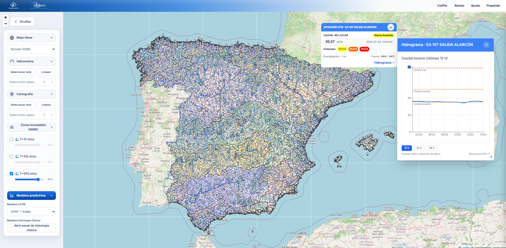
- Development of a functional version of the TARANIS geospatial web viewer.
- Initial integration of hydrometeorological data from gauging stations, rain gauges and official sources.
- Incorporation of cartographic layers of basins, river networks, sub-basins and potentially flood-prone areas.
- Development and evaluation of predictive models based on LSTM neural networks for streamflow forecasting.
- Initial visualisation, prediction and analysis tests carried out in the Adaja River basin.
Expected results
- Completion of the distributed architecture for the continuous acquisition of hydrometeorological and territorial data.
- Consolidation of the system for data processing, validation, harmonisation and storage.
- Improvement and validation of predictive models for streamflow, rainfall and flood risk.
- Development of the semantic engine to interpret variables according to the territorial context.
- Completion of the automated system for generating georeferenced and adaptive warnings.
- Validation of the platform through historical events, observed data and hydrological and hydraulic models.
This information will be updated as the project development, validation and testing activities progress.
Last update: July 2026.
Project gallery