
Support services for the development of Flood Risk Maps
Technical support services for the improvement of the Flood Risk Maps management and response to the Flood Risk Management Plan proposal to ensure compliance with the 2007/60/CE directive
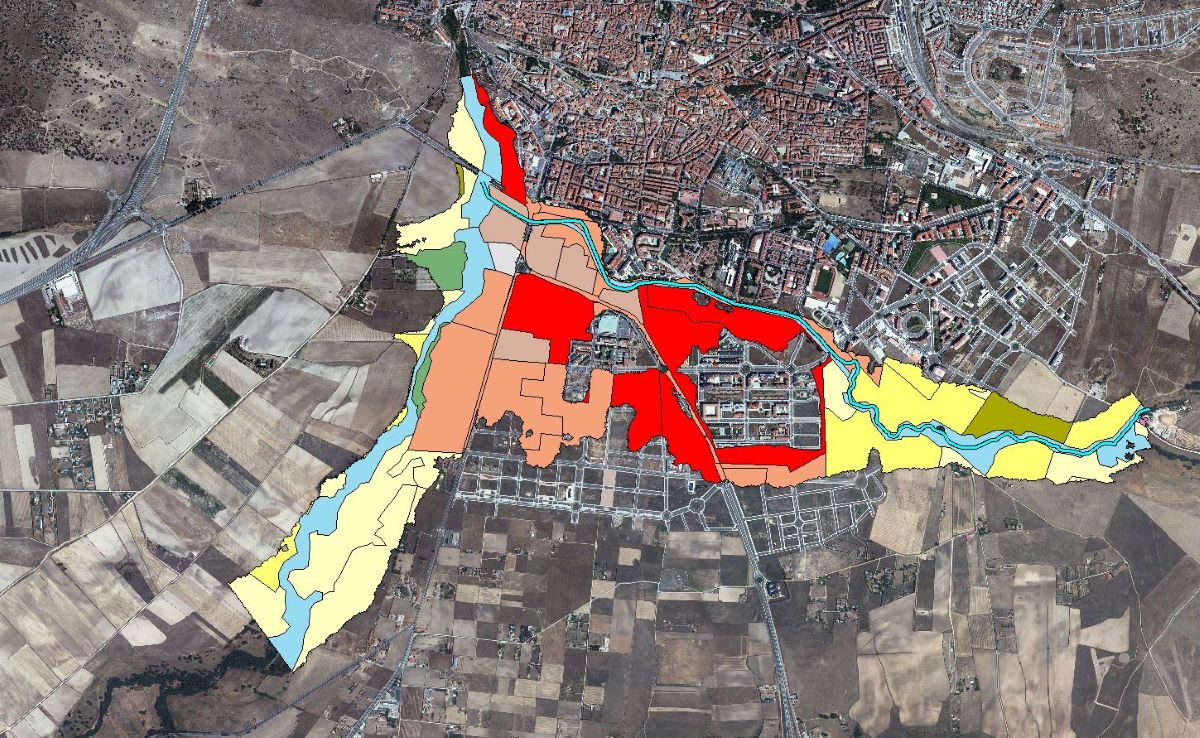
Description of the Works:
The work performed includes:
- Elaboration of Flood Risk Maps in expanded zones in relation to the Areas of Potential Significant Flood Risk (ARPSIs) and preparation of the layers for their inclusion in the viewer.
Customer: Confederación Hidrográfica del Duero
Allocation Date: April 2014
![]()
- Correction of the Flood Risk Management Plan Proposal after the public consultation period.
- Review and preparation of documents in response to the allegations received.
- Creation, management and processing of documents to be submitted to the “Consejo del Aguas de la Cuenca" y al “Comité de Autoridades Competentes".